Earth Sciences - Geology
155 items found
Davidson, T.
A monograph of British Cretaceous Brachiopoda. [AND] M. R. Sahni, the Terebratulidae of the British Chalk. [AND] N. E. Pettitt, The Rhynchonellidae of the British Chalk.
London, The Palaeontographical Society, 1854-1953. 4to (27.0 x 20.6 cm). 205 pp., 21 [12, 9] lithographed plates; 62 pp.; ten plates; 58 pp., three plates. Later half calf, spine with five raised, gilt bordered bands, and gilt titles on spine. Edges speckled red.
Read more
Lycett, J.
A monograph of the British fossil Trigoniae. [AND] Supplement to a monograph of the British fossil Trigoniae.
London, The Palaeontographical Society, 1875-1879; 1881-1883. Two parts in one. 4to (27.0 x 21.1 cm). [iv], 245 pp.; plates [numbered I-IX, 10-40, XLI], numerous text illustrations [the main work]; [iv] 19 pp.; four text figures, four plates [the supplement]. Contemporary red half calf over marbled boards. Spines with five raised, gilt-ornamented bands and two red morocco labels with gilt title. Brown endpapers; red speckled edges.
Read more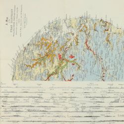
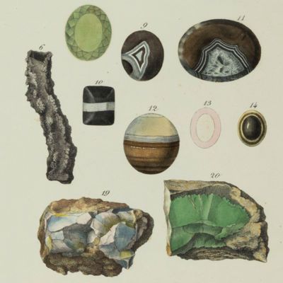
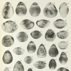
Wood, S. V.
A monograph of the Crag Mollusca, with descriptions of shells from the Upper Tertiaries of the British Isles. Part I. Univalves. Part II. Bivalves. Part III. Supplement to the Monograph of the Crag Mollusca, with descriptions of shells from the Upper Tertiaries of the east of England. Vol. III. Univalves and bivalves. [Part IV] Second supplement to the Crag Mollusca, comprising testacea from the Upper Tertiaries of the East of England. Univalves and bivalves. [Part V]. Third supplement to the Crag Mollusca, comprising testacea from the Upper Tertiaries of the east of England. [Complete].
London, The Palaeontographical Society, [1848-] 1850-1882. Five volumes in two. 4to (27.3 x 22.0 cm). 912 pp. [xii, 208; 342, 2; xxxi, 231; ii, 58; (ii), 24]; several text figures, 72 [21;31;13;6;1] lithographed plates with explanatory text leaves; one very large, multi-folded chart with profiles. Later uniform brown pebbled cloth with gilt title on the spines.
Read more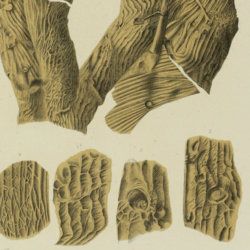
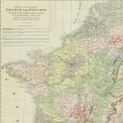
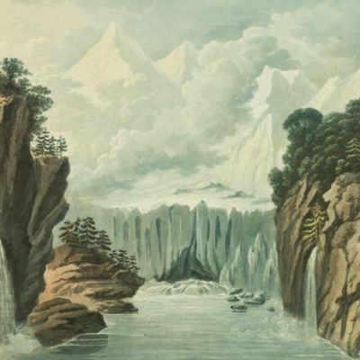
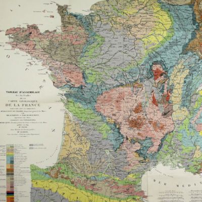
Beche, H. de la
A selection of the Geological Memoirs, contained in the Annales des Mines, together with a synoptical table of equivalent formations and Brongniart's table of the classification of mixed rocks. Translated with notes by H. T. de la Beche, Esq.
London, William Phillips, 1824. 8vo (21.1 x 13.3 cm). xxii, 335 pp.; one hand-coloured folded geological map of France and the Netherlands including a great part of Germany, the Alps and northern Italy, by J. d'Omalius d'Halloy (numbered plate 11 [not II]) and two further hand-coloured geological maps or profiles (numbered I-II), eight folded lithographed plates (numbered III-X), including a very fine view of the coalmine at Treuil near St. Etienne, one folding table. Contemporary half calf over marbled boards. Spine with gilt lines and title. Edges speckled red.
Read more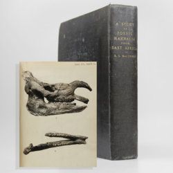
MacInnes, D.G.
A study of fossil Mammalia from East Africa [original manuscript].
Unpublished [n.d., but ca 1938.] 4to (26.0 x 20.4 cm). Original typed manuscript with 336 pp.; 143 original photographs in various sizes, and some original drawn maps. Full contemporary dark blue cloth with gilt title on spine.
Read more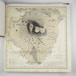
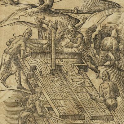
[Various authors]
Annales des Mines. Series III-VI. Atlases.
Paris, Ecole de Mines, 1832-1866. Two series in four. Oblong folio (40.5 x 22.0 cm) with 758 (of 759? see below) engraved and lithographed plates and maps, of which 29 are hand-coloured geological maps or profiles. Contemporary uniform red cloth. Gilt titles on the spines and front boards. Marbled endpapers.
Read more
Phillip, A.
Arthur Phillips Reise nach der Botany-Bay, nebst Auszügen aus den Tagebüchern der neuesten Brittischen Entdecker in der Südsee.
Hamburg, Benjamin Gottlob Hoffmann, 1791. 8vo (20.4 x 11.1 cm). [xiv], viii, [9]-264 pp.; one engraved portrait as a frontispiece, one engraved title vignette, eight engraved plates and one hand-coloured folded map. Contemporary mottled half calf over marbled boards. reen moroccolabel with gilt title on the spine. Blue endpapers.
Read more
Zannoni, R.
Atlas historique de la France ancienne et moderne contenant tous les lieux illustrés par les événements les plus mémorables de notre histoire; ... depuis Pharamond jusqu'a Louis XV....
Paris, S. Desnos, 1782. Large 4to (28.8 x 22.2 cm). Beautifully engraved double-sized title page; similar folding dedication page (by Desnos and Zannoni), 16 pp.; 59 hand-coloured engraved maps (56 double-sized with ornamental borders; two much larger, of which one dated 1774, and the other 1776). Contemporary half calf over marbled boards. Spine with five raised bands; compartments with gilt floral patterns and red morocco label with gilt title. Edges red.
Read more
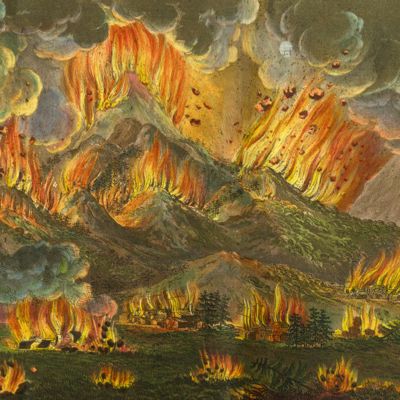
Lecoq, H.
[Auvergne] Itinéraire de Clermont au Puy de Dome, ou description de cette montagne et de la Vallée de Royat et Fontanat; seconde edition. [AND] Two other papers on the geology of Auvergne, by A. C. P. F. Von Lasaulx, and by J. B. Bouillet, bound in.
Paris, J. B. Baillière, 1836. 8vo (21.2 x 13.3 cm). vi, 102 pp. Early 20th century half morocco over marbled boards. Spine with five raised bands and gilt title. Marbled endpapers.
Read more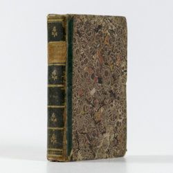
Radermacher, J. C. M. (ed.)
Bataviaasch Genootschap der Kunsten en Wetenschappen: Verhandelingen. Volume 1.
Batavia, Ter Lands Drukkerij, 1820. 8vo (18.6 x 12.5 cm) 266 pp., 59 pp. Voorbericht [foreword], 23 pp. Nabericht [afterword] and Bladwijzer [index]. Contemporary half calf with mottled paper over boards.
Read more