Rothpletz, A.
Ein geologischer Querschnitt durch die Ost-Alpen nebst Anhang über die sog. Glarner Doppelfalte.
Stuttgart, E. Schweizerbart (E. Koch), 1894. 8vo (22.4 x 15.4 cm). iv, 208 pp.; two full colour folded profiles of which one measuring 22.5 x 352.0 cm (!), 115 text illustrations. Contemporary half cloth over marbled boards. Gilt lines and two red morocco labels with gilt title on the spine. Edges speckled.
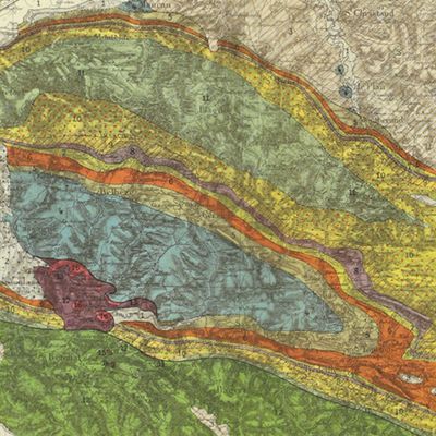
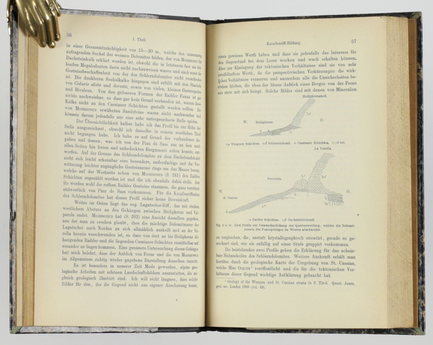
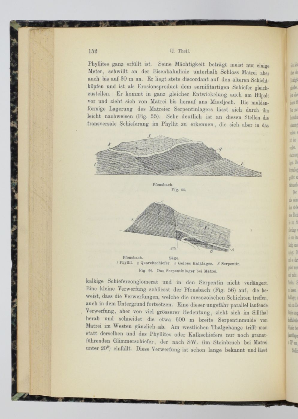
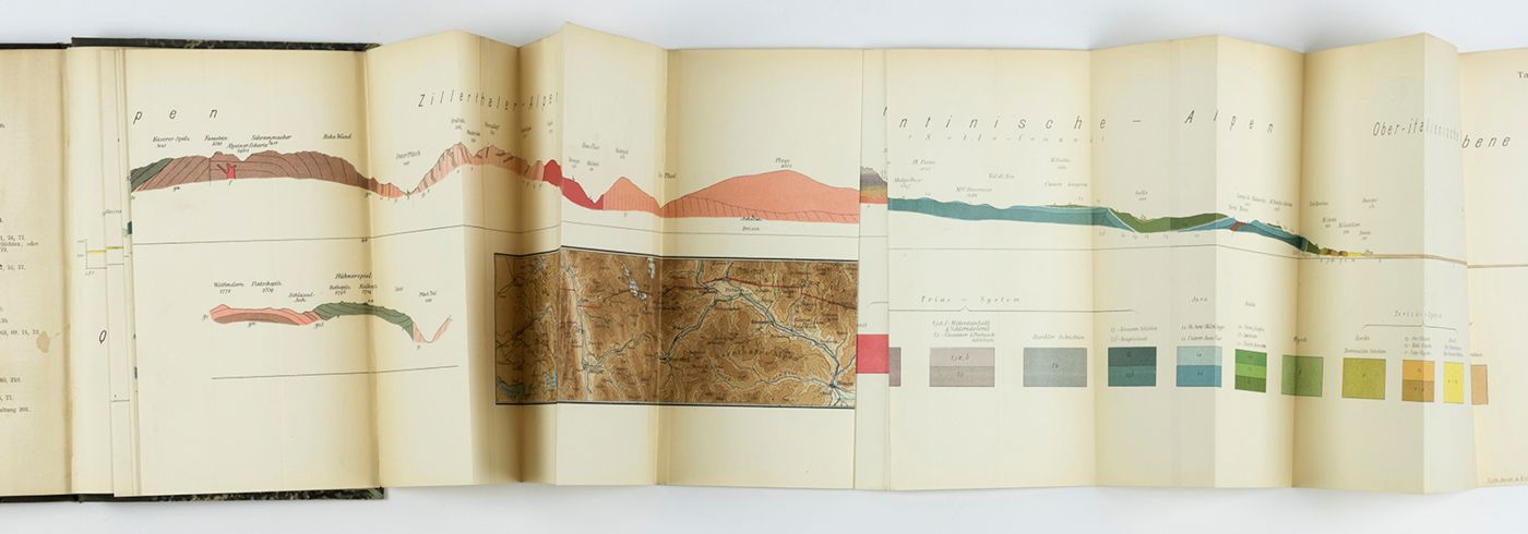
A fine and detailed study with excellent illustrations by the German geologist August Rothpletz (1853-1918) - the result of many years of field work in the Alps. The size of one of the folded profiles is simply amazing: over 3.5 meters or nearly 12 foot. It runs from Schäftlarn, near Münich, at 48º North, to Tezze in Italy, at 45º40' North, i.e., a distance of nearly 300 kilometers, all figured and coloured in great detail (scale 1:75,000), and accompanied by several shorter profiles of other sections and a map. The second folded chart has two profiles and a map. Small old stamp in the title page top margin and on the second, smaller chart verso, otherwise a very good, clean copy with the extremely long profile in perfect condition. Not in Ward and Carozzi.

![image for Halenza's neuestes Rhein-Panorama von Mainz bis Cöln. Einziges, durch die Berliner und Frankfurter Künstler gefässtes Urtheil, anerkanntes Kustwerk. Panorama du Rhin depuis Mayence jusq'à Cologne. Panorama of the Rhine, from Mentz to Cologne. [Complete with the rare text volume].](https://www.schierenberg.nl/media/cache/product_thumb/68289/68289_x.jpg)


