Geography
50 items found
Abendanon, E. C.
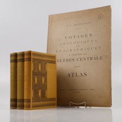
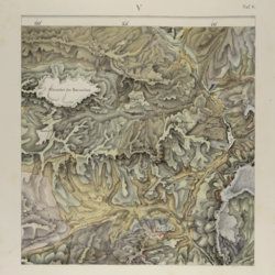
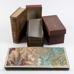
Expédition de la Célèbes Centrale. Voyages géologiques et géographiques à travers la Célèbes Centrale (1909-1910). Volumes I-III (text), atlas. [Complete].
Leiden, E. J. Brill, 1916. Three text volumes in three. 8vo (27.3 x 19.1 cm). 1615 pp. [xxviii, xvi, xxii,1549]; 183 plates and maps, 140 text figures. [AND] atlas folio (55.0 x 38.0 cm). Text with eight photogravures, 138 photographs, maps, numerous figures [AND] atlas with title page (double, French/Dutch) one coloured explanatory chart (36 different colours) and 17 mostly coloured folded geological maps and/or profiles (numbered 1, II, 3-11, 12a, 12b, 13-16). Original uniform black and gilt printed olive cloth (text), original printed portfolio (atlas).
Read moreAllemann, F.
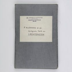
Geologische Karte Fürstentum Liechtenstein.
[Vaduz], Regierung des Fürstentums Liechtenstein, 1953. Large (102.0 x 67.0 cm), folded map, consisting of 25 rectangular sheets in full colour, mounted on linen. Handwritten and stamped label on the front-facing part of the linen map verso.
Read moreAndree, R.
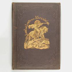
Abessinien, das Alpenland unter den Tropen und seine Grenzländer. Schilderungen von Land und Volk vornehmlich unter Koenig Theodoros (1855-1868) nach den Berichten älterer und neuerer Reisenden bearbeitet.
Leipzig, Otto Spamer, 1869. 8vo (19.1 x 13.7 cm). x, 300 pp.; wood-engraved, tissue-guarded frontispiece of King Theodoros with four lions; six engraved plates, 80 text illustrations (several page-sized). Original pictorial cloth. Spine with gilt title and pictorial vignettes; boards blind-stamped with floral borders, front board with large, gilt vignette. Endpapers with printed publisher's catalogue. Marbled edges.
Read moreAnville, [J. B. B.] d'
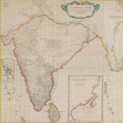
Carte de l'Inde. Dressée pour la Compagnie des Indies par le Sr. d'Anville, Secretaire de S.A.S. Mgr. le Duc d'Orléans. Paris, Novembre 1752.
Paris, Compagnie des Indes, 1752. Oblong broadsheet (97.2 x 111.5 cm), printed engraving with additional, contemporary hand-colouring (printed surface 87.8 x 104.5 cm).
Read moreArnold, F.
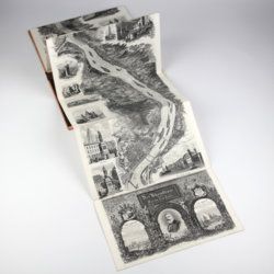
Halenza's neuestes Rhein-Panorama von Mainz bis Cöln. Einziges, durch die Berliner und Frankfurter Künstler gefässtes Urtheil, anerkanntes Kustwerk. Panorama du Rhin depuis Mayence jusq'à Cologne. Panorama of the Rhine, from Mentz to Cologne. [Complete with the rare text volume].
Mainz, J. Halenza, [1880]. Two parts in two. 8vo (text: 26.4 x 16.2 cm). Title page, 24 pp. (in English). Panorama: One folding lithographed view by F. Foltz (27 x 230 cm). Contained in original printed boards with the German title on one board, and the French/English titles on the other.
Read moreBelanger, L. and P. Vanlerberghe and S. Malgo
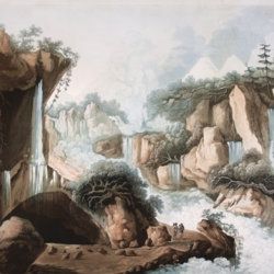
View of the torrent of the Lutschinen, and of the glaciers where it takes its source – Vue du torrent de la Lutschinen en Suisse, et des glaciers ou il prend sa source.
London, G. & W. Nicoll, 1800. Broadsheet (71.0 x 56.0 cm). Aquatint, finished by hand.
Read moreClairaut, J. B., a.o.
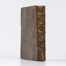
Miscellanea Berolinensia ad incrementum scientiarum ex scriptis Societati Regiae Scientiarum exhibitis. Edita, continuatio III, sive Tomus IV. Cum figuris et indice materiarum.
Berolini [Berlin], Johann Andreas Rüdiger, 1734. Small 4to (20.5 x 16.0 cm). vi, 405 pp.; 11 mostly folded engraved plates. Contemporary full mottled calf. Spine with five raised, gilt-ornamented bands; compartments rich gilt, red morocco label with gilt title. Edges speckled red.
Read moreCuvier, G. and A. [T.] Brongniart
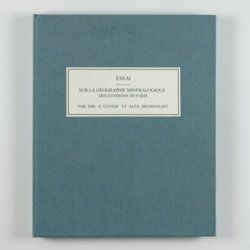
Essai sur la géographie minéralogique des environs de Paris. Proof copy of the introductions, with corrections by Brogniart.
Paris, Institut Impériale de France, [1809 or 1810]. 4to (25.0 x 20.0 cm). 33 pp. Not bound. In a 20th century blue hardcover paper drop-box (26.8 x 22.0 cm) with printed label on the top board.
Read moreDolomieu, D. [G. S. T.], De
Reise nach den liparischen Insuln oder Nachricht von den äolischen Insuln zur nähern Aufklärung der Geschichte der Vulkane. Nebst einer Abhandlung über eine Art von Luftvulkan, und einer andern über die Temperatur des Clima auf Maltha und die Verschiedenheit der wahren und fühlbaren Wärme.
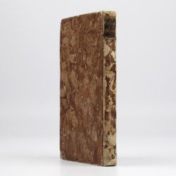
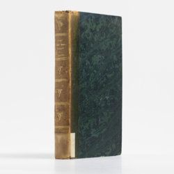
Leipzig, Johann Gottfried Müller, 1783. 8vo (16.7 x 10.1 cm). 210, [ii] pp. Contemporary marbled boards, small leather label with gilt title on the spine. Edges yellow.
Read moreEnouy, J.
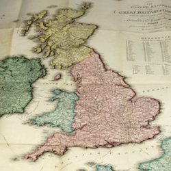
The United Kingdom of Great Britain & Ireland, with the adjacent parts of the Continent, from Amsterdam to Paris and Brest, compiled from a variety of the most authentic materials.
London, Samuel Leigh, 1818. Large, folded, coloured map (62.7 x 75.3 cm) of Great Britain and Ireland, and the continental coasts of the Channel and North Sea. In original reddish paper-covered boards, with printed label mounted.
Read moreFuchs, W.
Die Venetianer Alpen. Ein Beitrag zur Kenntniss der Hochgebirgte, met einen geognostischen Karte und Gebirgteprofilen in achtzehn Tafeln.
Solothurn, Jent & Gassmann, 1844. Oblong folio (29.8 x 35.5 cm), [4], 60 pp.; 18 mostly hand-coloured engraved maps and plates. Text pages bordered with putti and goddesses. 19th century iridescent blue blind cloth.
Read more[Geological map]
Geognostische Karte von Württemberg [AND] Begleitworte zur geognostischen Specialkarte von Württemberg.
Stuttgart, Das Königliches Statistisch-topographisches Bureau, Kohlhammer, Kleeblatt, 1863-1892. With 54 chromolithographed folded geological maps, all mounted on linen, numbered 1-48, 50-55, in two original, uniform burgundy boxes with gilt title on the lid. [AND] the "Begleitworte" 34 parts in one. Large 8vo (25.7 x 19.5 cm). Stuttgart, Königlich Statistischen Landesambt, (1865-1892). ca. 1,000 pp., and five hand-coloured wood-engraved or lithographed maps or geological profiles, and four wood-engraved plates. Contemporary half cloth over marbled boards. Spine with gilt title, ornaments, and the Württemberg coat-of-arms; patterned endpapers, and marbled edges.
Read moreGodefroy, P. J. and M. J. E. Muller and P. A. Fromm and P. Bleeker (eds.)
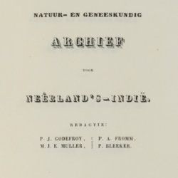
Natuur-en Geneeskundig Archief van Nederlands Indie. Volumes I-IV. [All published].
Batavia, the editors, 1844-1847. Four volumes in four. 8vo (22.0 x 12.7 cm). More than 2300 pp. (Volume I: vi, [1], [8], vi, [1], [7], 638 pp; Vol. II: v, 710 [1] pp.; Vol. III: v, 616 [1] pp.; Vol. IV: 340 [2] pp.), several plates (some larger, folding), many folding tables (mostly with meteorological data), errata leaf to Volume I. Matching red cloth with snakeskin-patterned boards.
Read moreGräffe, E., and others
Journal des Museum Godeffroy. Geographische, ethnographische und naturwissenschaftliche Mittheilungen. Heft II. [The complete geographical and ethnographical part].
Hamburg, L. Friederichsen, 1873. Large 4to (34.1 x 25.7 cm). 58 pp. Two maps (one very large, multi-folded), seven tinted plates. Original printed wrappers.
Read moreGranö, J. G.
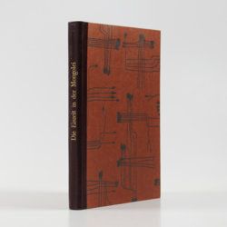
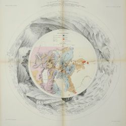
Beiträge zur Kenntnis der Eiszeit in der Nordwestlichen Mongolei und einigen ihrer südsibirischen Grenzgebirge. Geomorphologische Studien aus den Jahren 1905, 1906, 1907 und 1909.
Helsingfors, J. Simelii [for the Geographical Society of Finland], 1910. Large 8vo (24.9 x 16.5 cm). iv, 230 pp.; seven large, folded coloured maps, 19 photographic plates. Later quarter calf over pictorial boards.
Read moreGuillemin-Tarayre, E.
[Mission scientifique au Mexique et dans l'Amérique Centrale.] Description des anciennes possessions mexicaines du Nord.
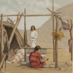
[Paris, Ministre de l'Instruction Publique (Imprimerie Nationale)], 1871. Large 4to (36.9 x 28.1 cm). 216 pp.; 29 text engravings, one coloured engraved map "Carte de la Haute Californie et de la Nevada" (not numbered), one lithographed plate of indigenous people ("p. 15"), 18 lithographed plates and maps, all but two double-sized or larger [numbered I-XVII, one not numbered], for a total of 20 plates and maps [Complete]. All leaves loose, as issued. Original printed wrappers.
Read moreHarris, W. H.
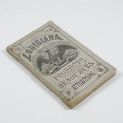
Louisiana products, resources and attractions, with a sketch of the parishes. A hand book of reliable information concerning the State.
New Orleans, LA, W. M. Harris [for the State], 1881. 8vo (23.4 x 14.9 cm). 248 pp., one large, folded coloured map, one lithographed frontispiece portrait. Original pictorial wrappers. In protective transparent cover.
Read moreHochstetter, F. von and A. Petermann.
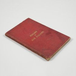
The geology of New Zealand: in explanation of the geographical and topographical atlas of New Zealand by Dr. F. Von Hochstetter and Dr. A. Petermann, from the Scientific Publications of the Novara Expedition. Translated by C. F. Fischer. Also, lectures by Dr. F. Hochstetter delivered in New Zealand.
Auckland, T. Delattre, 1864. 8vo (21.0 x 13.6 cm). Title page, 113 pp. Original grained red cloth with gilt title on the front board.
Read moreHogendorp, W. van, a.o.
Verhandelingen van het Bataviaasch Genootschap der Konsten en Wetenschappen. Tweede deel. [Volume 2].
Rotterdam, R. Arrenberg, 1784. 8vo (22.5 x 13.7 cm). 488, 90 pp.; two engraved title vignettes. Contemporary half calf over speckled boards. Spine with five raised, gilt-bordered bands; two morocco labels with gilt title and volume number.
Read more["JAM" (R. de Bouillé, Comte)]
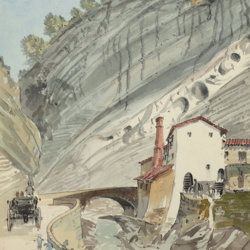
[Original watercolour sketches of French landscapes]
[France], no place, no publisher, ca. 1863-1890. 13 oblong sheets (22.3 x 29.2 cm), all with fine watercolour paintings, either full-sized, or smaller, in a drawn rectangular frame. And one drawing on slightly smaller paper, more sketchy, in pencil.
Read moreKaempfer, E.
De beschryving van Japan, behelsende een verhaal van den ouden en tegenwoordigen staat en regeering van dat Ryk.
The Hague, P. Gosse and J. Neaulme; Amsterdam, Balthasar Lakeman, 1729. Folio (37.5 x 25.0 cm). 500 pp. Half-title, title page explanation, frontispiece (engraved title) by I. C. Philips, letterpress title in red and black; 48 double-sized maps and plates (I-XVII, XXX-XLV, XXIV*, A-BXXVIII, A-BXXIX). Contemporary full mottled calf; spine with six raised bands; compartments rich gilt with fine, elaborate floral ornaments, and red morocco label with gilt title; boards with double gilt roll stamped border, gilt floral corner pieces and central vignettes. Mottled edges.
Read moreKan, C. M. and N. W. Posthumus (eds.)
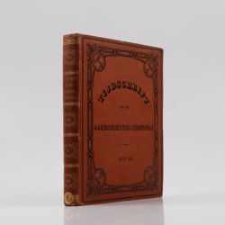
Tijdschrift van het Aardrijkskundig Genootschap, gevestigd te Amsterdam. Eerste Deel [Journal of the Geographical Society in Amsterdam, Volume 1].
Amsterdam, C. F. Stemler, 1876. 4to (28.2 x 24.0 cm). xl, 405 pp.; 11 maps, including several (very) large and/or coloured. Original brown pebbled cloth, richly embossed in gilt and black.
Read moreLe Goux de Flaix, A. [Legoux]
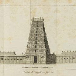
Historisch-geographisch politischer Versuch über Ostindien nebst der Schilderung von dessen Handel nach Le Goux de Flaix. Mit Noten, Anmerkungen und einer Vorrede von E. A. W. v. Z[immermann].
Leipzig, Heinrich Gräff, 1810. Two volumes in two. 8vo (17.5 x 10.7 cm). 892 [I: viii, 444; II: iv, 436] pp.; one folded engraving of the Jagannath temple. Contemporary uniform tree calf resembling paper boards with ruled borders, olive and brown gilt-lettered morocco labels on spines.
Read moreLecoq, H.
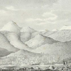
[Auvergne] Itinéraire de Clermont au Puy de Dome, ou description de cette montagne et de la Vallée de Royat et Fontanat; seconde edition. [AND] Two other papers on the geology of Auvergne, by A. C. P. F. Von Lasaulx, and by J. B. Bouillet, bound in.
Paris, J. B. Baillière, 1836. 8vo (21.2 x 13.3 cm). vi, 102 pp. Early 20th century half morocco over marbled boards. Spine with five raised bands and gilt title. Marbled endpapers.
Read moreLesseps, [J. B. B.] de
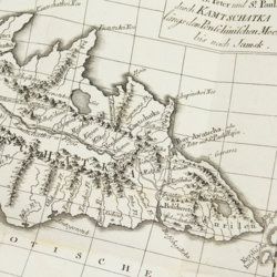
Herrn von Lesseps Gefährten des Grafen de la Perouse Reise durch Kamtschatka und Sibirien nach Frankreich. Aus dem Französischen übersetzt. Mit Anmerkungen von Johann Reinhold Forster.
Berlin, Voss, 1791. 8vo (22.4 x 14.5 cm). xxviii, 302 [303-544] pp.; two engraved, folded maps, one folded table. Original blind boards.
Read moreLovassy, A.
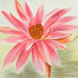
Resultate der wissenschaftlichen Erforschung des Balatonsees. Mit Unterstützung der hohen Kön. Ung. Ministerien für Ackerbau und für Cultus und Unterricht. Zweiter Band. Die Biologie des Balatonsees und seiner Umgebung. Zweiter Theil. Die Flora. II. Sektion. Die Pflanzengeographischen Verhältnisse der Balatonsee-Gegend. Anhang. Die trophischen Nymphaeen des Hévizsees bei Keszthely.
Wien, Ed. Hölzel, 1909. Large 4to (29.3 x 21.2 cm). 91 pp.; four plates of which three in chromolithography. Original printed wrappers.
Read moreMaupertuis, P.L. Moreau de
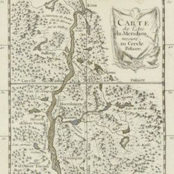
Sur la Figure de la Terre déterminée par Messieurs de l'Académie royale des Sciences, qui ont mesuré le degré du méridien au Cercle Polaire.
Paris, l'Imprimérie Royale, 1740. 4to (25.8 x 20.2 cm). pp. 90-96; 389-469 In: Histoire de l'Académie royale des Sciences Année MDCCCXXXVII. Engraved allegorical frontispiece; title page; [vi], 120, 492 pp.; engraved map of Lapponia; five engraved, folded plates. Contemporary full polished calf. Boards with double gilt borders; spine with five raised bands, gilt floral patterns and two red morocco labels with gilt title. Gilt floral inner dentelles. Marbled endpapers. Mottled edges.
Read morePetermann, A. [H.] (ed.)
Petermann's Geographische Mitteilungen. Volumes 1-12. [Mittheilungen aus Justus Perthes' geographischer Anstalt über wichtige neue Erforschungen auf dem gesammtgebiete der Geographie von Doktor A. Petermann].
Gotha, Justus Perthes, 1855-1865. 12 volumes in 12. 4to (22.2 x 26.8 cm). Over 3,500 pp., numerous maps of which many large, folded, and nearly all in fine chromolithography. Contemporary uniform polished half calf over marbled boards. Spines with five raised, gilt and black-lined bands, red and black morocco labels with gilt title, number and year (volumes 1-9), and gilt ornaments and title (volumes 10-12). Marbled endpapers. Speckled edges.
Read morePhillip, A.
Arthur Phillips Reise nach der Botany-Bay, nebst Auszügen aus den Tagebüchern der neuesten Brittischen Entdecker in der Südsee.
Hamburg, Benjamin Gottlob Hoffmann, 1791. 8vo (20.4 x 11.1 cm). [xiv], viii, [9]-264 pp.; one engraved portrait as a frontispiece, one engraved title vignette, eight engraved plates and one hand-coloured folded map. Contemporary mottled half calf over marbled boards. Green morocco label with gilt title on the spine. Blue endpapers.
Read moreRadermacher, J. C. M. (ed.)
Bataviaasch Genootschap der Kunsten en Wetenschappen: Verhandelingen. Volume 1.
Batavia, Ter Lands Drukkerij, 1820. 8vo (18.6 x 12.5 cm). 266, 59 pp. Voorbericht [foreword], 23 pp. Nabericht [afterword] and Bladwijzer [index]. Contemporary half calf with mottled paper over boards.
Read moreRobidé van der Aa, P.
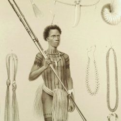
Reizen naar Nederlandsch Nieuw-Guinea ondernomen op last der regering van Nederlandsch-Indië in de jaren 1871-1872, 1875-1876 door de heeren P. van den Crab en J. E. Teysmann, J. G. Coorengel en A. J. Langeveldt van Hemert en P. Swaan. Met geschied- en aardrijkskundige toelichtingen door P. J. B. C. Robidé van der Aa.
's-Gravenhage [The Hague], Martinus Nijhoff, 1879. Large 8vo (23.4 x 15.4 cm). xlii, 480 pp., two large, folding maps. Later red cloth over speckled boards. Spine with title in black.
Read moreRothpletz, A.
Ein geologischer Querschnitt durch die Ost-Alpen nebst Anhang über die sog. Glarner Doppelfalte.
Stuttgart, E. Schweizerbart (E. Koch), 1894. 8vo (22.4 x 15.4 cm). iv, 208 pp.; two full colour folded profiles of which one measuring 22.5 x 352.0 cm (!), 115 text illustrations. Contemporary half cloth over marbled boards. Gilt lines and two red morocco labels with gilt title on the spine. Edges speckled.
Read moreRouge, G. L. Le
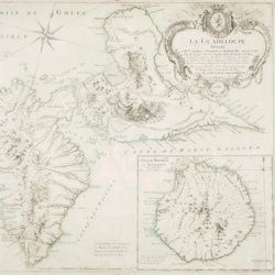
La Guadeloupe dediée a Mgr. Charles Philippe d'Albert Duc de Luynes ... par son trés humble et trés obeissant serviteur Le Rouge, Ingr. géographe du Roy. [map of Guadeloupe and Bourbon (La Réunion)].
Paris, Dien, 1788. Broadsheet (56.4 x 49.1 cm). With contemporary hand-coloured contours.
Read moreSaulcy, [L.] F. [J. C.] de
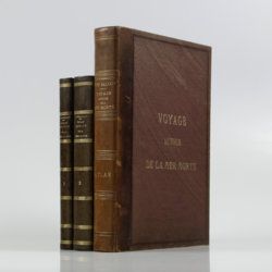
Voyage autour de la Mer Morte et dans les terres bibliques exécuté de décembre 1850 à avril 1851. Relation de voyage; atlas. [Complete].
Paris, Gide et J. Baudry, 1852-1853. In two text volumes and one atlas volume. 8vo (24.5 x 16.0 cm [text]). 1054 pp. [399; 655]). Folio/large 4to (31.0 x 23.7 cm [atlas]). 172 pp. [4, vii, 20, i-iv, 5-19; xxvi, 96]; 15 maps on 14 sheets (one double-sized); 61 (LVII; 4) lithographed plates (several tinted). Text in near contemporary uniform half calf over marbled boards. Spines with gilt bands and title; Atlas in contemporary half morocco over grained, cloth with gilt title on the front board and spine. Marbled endpapers. Original printed wrappers of the text volumes bound in.
Read moreSonnini, C. S.
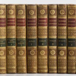
Histoire naturelle générale et particulière, par Leclerc de Buffon; nouvelle edition accompagnée de notes, et dans laquelle les supplémens sont insérés dans le premier texte, à la place qui leur convient. Ouvrage formant un cours complet d'histoire naturelle; redige par C. S. Sonnini, membre de plusieurs sociétés savantes. Tomes Mineraux 1-16. [Théorie de la terre 1-3; Epoques de la nature; Introduction a l'histoire des minéraux 1-3; Mineraux 1-9].
Paris, Dufart, An VIII (1798) - X (1800). 16 parts in 16. 8vo (19.5 x 12.2 cm). Engraved frontispiece, 7156 pp.; nine engraved plates, four folded maps. Contemporary uniform full tree calf. Boards with gilt ornamented borders and gilt dentelles. Rich gilt spines, gilt titles on two (red and black) morocco labels, marbled flyleaves, all edges speckled red on yellow.
Read moreSouvenir of Cape of Good Hope
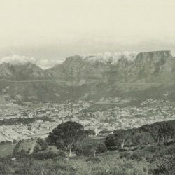
Souvenir of Cape of Good Hope.
Cape Town [?], "G. B. & Co.", ca. 1900. Oblong, large folio (22.0 x 57.0 cm). 71 photos in heliogravure, including 11 wide panoramas, and 15 groups of four smaller photos. Original pebbled cloth in grey and red, with gilt title on the front board. Marbled endpapers.
Read moreSquier, E. G. and E. H. Davis
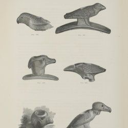
Ancient monuments of the Mississippi Valley: Comprising the results of extensive original surveys and explorations.
Washington, [DC], The Smithsonian Institution, 1848. Large 4to (30.0 x 23.3 cm). 345 [xxxix, 306] pp.; 47 engraved or tinted lithographed (tissue-guarded) plates, 207 text engravings. Later black half morocco over black linen. Gilt title on spine, gilt logo on front board. Speckled edges.
Read moreTissot, C. [J.]
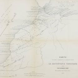
Recherches sur la géographie comparée de la Maurétanie tingitane.
Paris, Académie des Inscriptions et Belles-Lettres, 1877. 4to (27.8 x 22.1 cm). 184 pp. [numbered 139-322]; six maps and plates, including a very large, multifolded map of Morocco and adjacent areas. Original blue wrappers with printed label on the spine.
Read moreTorre, G. M. Della
Histoire et phénomènes du Vésuve. Exposés par le Pere Dom Jean-Marie Della-Torre, clerc régulier sommasque, garde bde la bibliothéque & du cabinet du roi des Deux-Siciles, & correspondant de l'Académie Royale des Sciences de Paris. Traduction de l'Italien par M. l'abbé Péton.
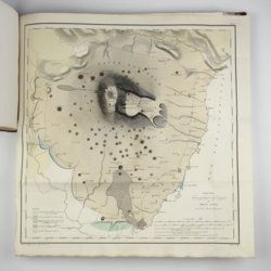
Paris, Jean-Thomas Hérissant, 1760. 12mo (16.3 x 9.2 cm). xxiv, 399 pp., one large folded map of Mount Vesuvius, the Bay of Naples and surroundings, and five folded plates with panoramas and other views of the volcano, caldera, etc. Contemporary full mottled calf. Spine with five raised bands. Compartments with gilt floral vignettes and small red morocco label with gilt title. Marbled endpapers, marbled edges.
Read moreUnger, F.
Ueber den Einfluss des Bodens auf die Vertheilung der Gewächse nachgewissen in der Vegetation des nordöstlichen Tirols.
Wien, Rohrmann und Schweigerd, 1836. 8vo (21.4 x 13.5 cm). xxiv, 367 pp.; one hand-coloured engraved plate of Kitzbühl, one large, folded, hand-coloured geological-geographical map, one large, folded hand-coloured sheet with geological profile, five folded charts with meteorological observations (four) and botanical observations (one), many tables in the text. Contemporary quarter calf over marbled boards. Spine with gilt lines, vignettes, and title. Marbled endpapers; speckled edges.
Read more[Various authors]
Annales des Mines. Series III-VI. Atlases.
Paris, Ecole de Mines, 1832-1866. Two series in four. Oblong folio (40.5 x 22.0 cm) with 758 (of 759? see below) engraved and lithographed plates and maps, of which 29 are hand-coloured geological maps or profiles. Contemporary uniform red cloth. Gilt titles on the spines and front boards. Marbled endpapers.
Read moreVincendon-Dumoulin, [C. A.] and C. [L. F.] Desgraz
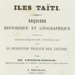
Iles Taïti. Esquisse historique et géographique précédée de considérations générales sur la colonisation française dans l'Océanie. Première Partie - Deuxième Partie. [Complete].
Paris, Arthus Bertrand, 1844. In two parts. 8vo (21.5 x 14.1 cm). Half-titles, title pages, 1056 pp. (pagination continuous); two large, engraved maps. Original uniform, printed wrappers.
Read moreWheeler, G. M.
Report upon United States Geographical Surveys west of the one hundredth meridian, in charge of Capt. Geo. M. Wheeler. Vol. I. - Geographical report.
Washington, DC, Government Printing Office, 1889. Large, thick 4to (29.3 x 23.5 cm). 780 pp.; 38 fine, tinted lithographed plates (several in chromolithography, tissue-guarded), three (very) large folded maps [listed as plates I-XXXVIII and Maps 1-3]. Publisher's embossed cloth. Spine with gilt vignette and title. Printed errata slip bound in; Wheeler's printed compliments tipped in on the front pastedown.
Read more