Mille, M. et al.
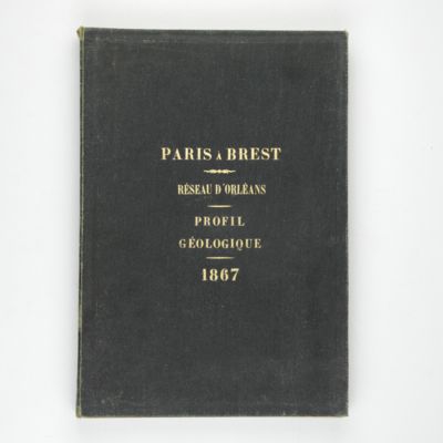
Contrôle des Chemins de Fer. Ligne de Paris à Brest. Réseau d'Orléans. Profil géologique suivant le tracé du chemin de fer dressé sur les indications de M.M. Triger et Delesse. Notice par M. Mille ingénieur en Chef des Ponts et Chaussées 1867.
Paris, Jules Bonaventure, 1866-1867. In four parts. 4to. Title-page, 9 pp. (text volume); one folded, chromolithographed profile (31.0 x 99.8 cm), titled: Coupe des huillères de Chalonnes d'après les travaux des ingénieurs de la mine; one very long folded profile (31 x 957 cm, including title and legend) titled: Section de Paris à Angers par Vendôme et Tours; a second very long folded chromolithographed profile (31 x 1147 [!] cm), title: Section de Angers à Brest par Nantes et Chateaulin. All four contained in a blind stamped cloth portfolio with gilt title on the spine and top board.
The amazingly long profile runs from Paris to Brest, at the western tip of Brittany, in a scale of 1:40.000. Total length of the sheets is some 22 meters, all printed and coloured in fine detail. In fact the profile is even longer, as some additional profile sections are printed below the main sequence. The surface topography is shown, including hills and valleys, and the places were towns are situated, as well as the occasional chateau, wind mill, river, etc., all subterranean geological layers with their names (each coloured differently), and all relevant coordinates and topgraphical names. This is the work of engineers of the French "Corps des ingénieurs des ponts et chaussées", founded in 1716, and who have been responsible for all road, bridge, and railroad development in France ever since. A massive and wonderful work. Rare. Neither in Brunet nor in Ward and Carozzi.


![image for Documents decoratifs. Planche 19. [Examples of engraved titles]](https://www.schierenberg.nl/media/cache/product_thumb/69785/69785_x.jpg)
![image for Documents decoratifs. Planches 61-62. [Silverware]](https://www.schierenberg.nl/media/cache/product_thumb/69775/69775_x.jpg)


