Oeynhausen, C. von and H. von Dechen and H. von La Roche
Geognostische Umrisse der Rheinländer zwischen Basel und Mainz mit besonderer Rücksicht auf das Vorkommen des Steinsalzes, nach Beobachtungen entworfen auf einer Reise im Jahre 1823 gesammelt.
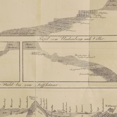
Essen, G. Bädeker, 1825. Two volumes in one. 8vo (19.8 x 12.0 cm). 782 pp.; one folding lithographed plate with several geological profiles. Contemporary half cloth over marbled boards. Paper label with the title in an old hand on the spine. Original endpapers.
One of the first geological descriptions of this southern part of Germany (and adjacent countries), viz. the Taunus, Schwarzwald, Vosges, as well as the Swiss Jura and the Schwäbische Alb. Especially interesting because of the description of the petrographic formation of these mountains. Karl [Carl] August Ludwig Freiherr von Oeynhausen (1795-1865), the main author, was a wealthy German geologist and patron, who popularised the salt bath of the famous spa now named Bad Oeynhausen. In the introduction on page v the authors state "Mit dem vorliegende Werke in Verbindung steht eine geognostische Charte in 2 Blättern", which is nearly always lacking as it was published by another publishing house in Berlin. Boards a bit rubbed, front flyleaf clipped, erased stamp on title. The folded map reinforced, otherwise a good copy. Very rare. Zittel, p. 513.


